![]()
![]()
7.0 Marietta
7.1 Risk and Hazard Assessment
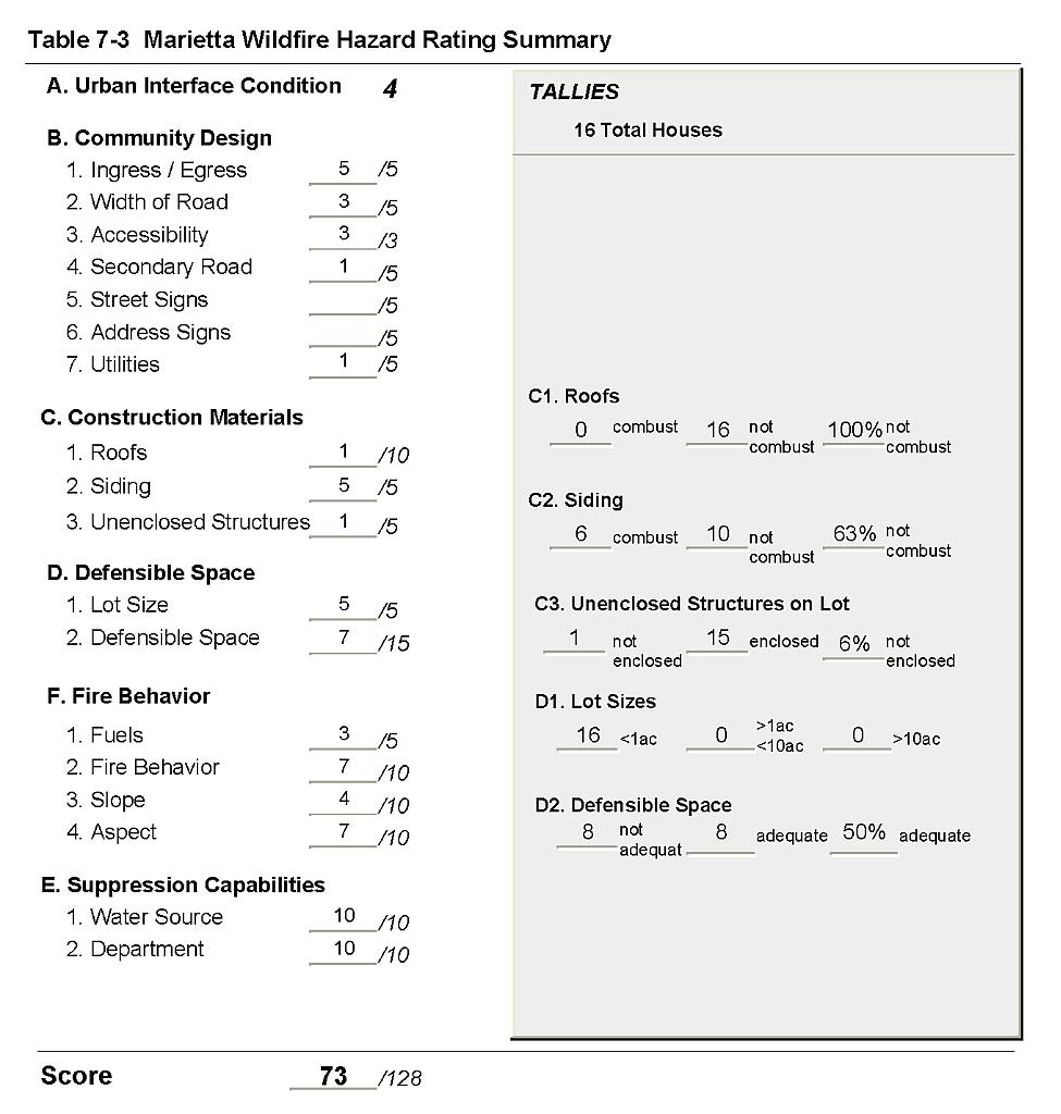
Marietta is located in the southern portion of Mineral County west of State Highway 360. Marietta is approximately 23 miles southwest of Mina, and situated in a canyon on the eastern slope of the Excelsior Mountains. There are about four (4) full-time residences in Marietta. The assessment resulted in classifying Marietta in the High Hazard category (73 points). A summary of the values that contribute to this hazard rating is included in at the end of this chapter in Table 7-3. The primary factors affecting the High Hazard score were limited ingress and egress to the community, lack of defensible space around most of the structures, and lack of a community fire protection service.
7.1.1 Community Design
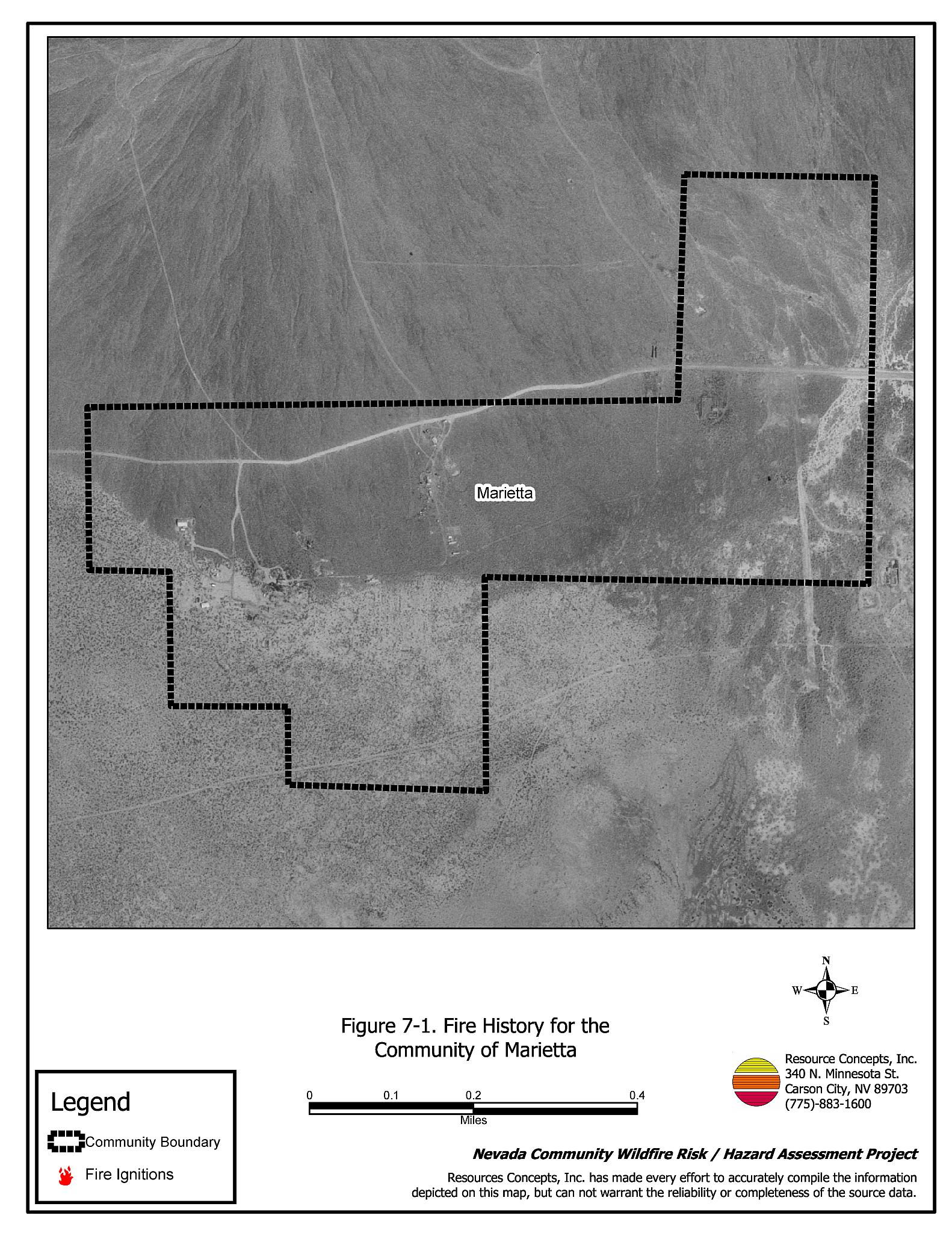
Marietta is a rural interface community with only three of the 16 residential structures occupied full-time. The majority of the structures are travel trailers for summer visitors. These scattered structures are widely spaced with wildland fuels between them. Lot sizes are all less than one acre in size. One resident owns 160 acres that includes the Marietta town site and the surrounding area (see Figure 7-1).
- Roads: Marietta has one graded dirt road in and out of the community. This road is a rural road with a width of 20 to 24 feet and a road grade in excess of 5 percent. The road grade, along with limited ingress and egress to the community could pose a risk to fire suppression personnel during a wildland fire.
- Signage: There are no street signs. None of the homes have easily visible addresses. However, the community is small in size and all homes are easily visible from the single access road into the community. There would be little chance of fire suppression personnel being unable to locate a particular structure that needed protection.
- Utilities: Marietta has no electric service. One of the residents has a generator. There are no above ground utility lines that could pose an ignition risk. Faulty extension cords connecting generators to buildings are a potential ignition risk.
7.1.2 Construction Materials
Approximately one-third of the structures in the community are built with combustible siding materials. All of the structures have fire resistant roof materials such as composition roofing, metal, or tile. One of the homes observed had an architectural feature such as an unenclosed balcony, porch, or deck that could create drafts and provide areas where sparks and embers can smolder and rapidly spread fire to the home.
7.1.3 Defensible Space
The vegetation fuel density in Marietta varies. Fuels in the community consist primarily of sage, rabbitbrush, and cheatgrass. The fuel loading surrounding the cluster of structures was estimated at one ton per acre. Among the structures, the fuel density increases with increasing shrub size. Slope in the area varies from 8 to 20 percent with a western aspect. Less than 70 percent of the structures have adequate defensible space. See the Defensible Space Guidelines and the Homeowner’s Annual Checklist in Appendix D for detailed information on defensible space.
7.1.4 Suppression Capabilities
Wildfire Protection Resources
Marietta does not have any organized fire protection in the community. The closest fire protection agency is the volunteer fire department in Mina, approximately 23 miles away. In the event of a wildland fire, resources would be summoned from Mina and Hawthorne.
| Response Time | Type of Resources | Amount of Equipment | Cooperating Partner (Resource Location) |
|---|---|---|---|
| 10 - 30 minutes | |||
| 1 - 2 hours | Engine Engine Rescue/Brush Truck Water Tender (3,000 gal.) Water Tender (5,000 gal.) |
1 1 1 1 1 |
Mina VFD (Mina) Mineral County FD (Hawthorne) |
| 2+ hours | Engine Air Tanker Hand Crew |
1 1 2 |
BLM and NDF (Closest available resources dispatched from the Sierra Front Interagency Dispatch Center, Minden) |
| Source: Personal communication with Chief Craig Nixon, Mineral County Fire Department. | |||
Water Sources and Infrastructure
There is no community water system. There are no fire hydrants in the community.
Detection and Communication
There is no fire detection and communication system in place.
Fire Protection Personnel Qualifications
Not applicable.
Work Load
Not applicable.
Financial Support
Not applicable.
Community Preparedness
No formal plans.
7.1.5 Factors Affecting Fire Behavior
Marietta is surrounded on three sides by mountains with prevailing winds from the west/southwest. Slopes vary from 5 to 10 percent with a predominantly west aspect. Fuel density is moderate in the area surrounding the structures, estimated at approximately one ton per acre. Fuels consist primarily of black greasewood (Sarcobatus vermiculatus), fourwing saltbush (Atriplex canescens), spiny hopsage (Grayia spinosa), rabbitbrush (Ericameria sp.), and cheatgrass. Fuel density is greater among the structures where the shrub sizes increase. This topographic arrangement and fuel composition, coupled with the distance to the nearest organized fire suppression agency (Mina VFD), contribute to Marietta’s high hazard rating.
7.1.6 Fire Behavior Worst Case Scenario
A worst-case scenario for Marietta would occur in late afternoon on a high hazard day. Winds from the west would push a fire into the existing structures (trailers). Brush and general debris around the structures would fuel the fire. There are no fire suppression resources within an hour of the community. By the time the fire resources summoned from Mina and Hawthorne arrived onsite, it is likely that the fire would have consumed all of the structures in the community.
7.1.7 Ignition Risk Assessment
The Risk Assessment resulted in assigning a high ignition risk rating to Marietta, due in part to the composition of the fuels in the interface. Though there are no historic fire polygons in the area, there is an ignition history to the north and east of Marietta (see Figure 3-2). Ignition risks fall into two categories - lightning and human caused. Human caused ignitions can come from a variety of sources: fires started along highways and county roads from burning material thrown out of vehicle windows or ignited during auto accidents; off-road vehicles; railroads; arcing powerlines; agricultural fires; ditch burning; debris burning in piles or burn barrels; matches, and fireworks are a few examples of ignition sources for human caused wildfires.
7.2 Risk and Hazard Reduction Recommendations, Roles, and Responsibilities
The Marietta Risk Reduction Recommendations focus on defensible space. Other recommendations pertain to community coordination and public education efforts that could be undertaken to enhance fire safety in Marietta. The recommendations are detailed below and summarized in Table 7-2.
7.2.1 Defensible Space Treatments
Following are some general guidelines for improving defensible space around residences and structures in the community.
Property Owner Responsibilities
- Remove, reduce, and replace vegetation around homes according to the guidelines in Appendix D. This area should be kept:
- Lean: There are only small amounts of flammable vegetation,
- Clean: There is no accumulation of dead vegetation or other flammable debris,
- Green: Existing plants are healthy and green during the fire season.
- Maintain the defensible space condition as needed.
- Clear all vegetation and combustible materials around propane tanks for a minimum distance of 10 feet.
- Prevent cheatgrass growth by annual applications of pre-emergent herbicides in the late fall and/or early spring, applied immediately before rainfall, or applied and followed by a light watering. In the absence of chemical control, use a weed eater or mower to effectively remove the green plants. It is important to mow prior to seed maturity and to rake and remove the cut material to eliminate the fuel hazard.
- Remove or clean up abandoned structures.
7.2.2 Community Coordination
Coordination among local, state and federal fire suppression agencies is important in the day-to-day fire prevention activities and becomes critical in the event of a wildland fire. During a fire event, firefighters from other communities and states may be dispatched to areas they have never been before. This is particularly true in areas like Marietta that have no local fire suppression resources and will be dependent on an outside agency in the event of a catastrophic wildland fire. The following recommendations should be implemented in Marietta that relate to community coordination.
Property Owner Responsibilities
- Ensure utility line power cords from generators to structures are installed to current building code standards.
- Install 1,000-gallon water tanks for structure protection or develop other on-site water storage that could be used as a dip or drafting site for fire suppression equipment.
- Develop an emergency evacuation plan with the Mineral County Sheriff Department. Become trained in safety procedures for sheltering in place in the event that evacuation routes become blocked by smoke or flames.
7.2.3 Public Education
Public education about how to become more fire safe is critical for communities in remote locations such as Marietta. Informed community members will take the initiative required to lead efforts of a scale sufficient to effectively reduce the threat that wildland fires present to the entire interface community.
Mineral County Responsibilities
- Distribute copies of the publication “Living with Fire” to all property owners. This publication is free of charge. Copies can be requested from the University of Nevada Cooperative Extension, (775) 784-4848.
7.3 Summary of Recommendations
| Responsible Party |
Recommendation Description |
|---|---|
| Property Owners | Remove, reduce, and replace vegetation according to the defensible space guidelines in Appendix D. Maintain defensible space. Clear all vegetation and combustible materials around above ground fuel tanks for a minimum distance of 10 feet. Mow or treat cheatgrass and other undesirable vegetation with an application of pre-emergent herbicide prior to seed set. Repeat mowing each year as necessary to ensure that the seed bank of unwanted grasses has been depleted. Refer to Appendix D for approved seed mixes and planting guidelines that can be used in conjunction with removal of this annual grass. Remove or clean up abandoned structures. Ensure utility line power cords from generators to structures are installed to current building code standards. Install 1,000-gallon water tanks for structure protection or develop other on-site water storage that could be used as a dip or drafting site for fire suppression equipment. Develop an emergency evacuation plan and become trained in safety procedures for sheltering in place in the event that smoke or flames block the evacuation route. |
| Mineral County | Distribute copies of the publication “Living with Fire” to all property owners. |
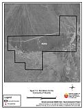
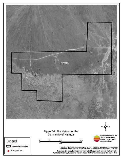
Figure 7-1Fire History for the Community of Marietta |
 |
Table 7-3Marietta Wildfire Hazard Ratings Summary |
 |